Greensboro Piedmont Triad International Airport (GSO)
Orientation and Maps
(Greensboro, North Carolina (NC), USA)
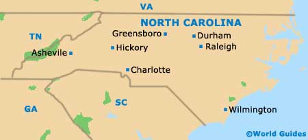
The third-largest city in the whole of North Carolina, Greensboro is also the county seat, being located in Guilford County. Greensboro is also the main city within the Piedmont Triad area, which is often referred to as simply 'The Triad' and also incorporates nearby High Point and Winston-Salem.
The Triad region is linked by a number of highways, including the I-40, the I-73, the I-74 and the I-85 interstates, with the Greensboro Piedmont Triad Airport (GSO) serving all three cities. With a population of roughly 224,000 people, the city of Greensboro is also served by Greyhound buses, with the terminal being located along West Lee Street. Nearby, Amtrak trains arrive and depart from the station along Oakland Avenue.
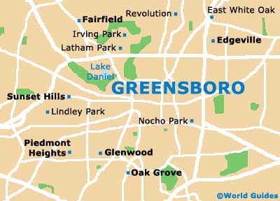
Greensboro Piedmont Triad Airport (GSO) Maps: Important City Districts
The downtown district of Greensboro is full of life and much of this area has been renovated. Home to countless well-preserved buildings which date back to the beginning of the 1900s, downtown Greensboro is also full of places to eat, drink and be entertained. Many of the city's most popular restaurants can be found along Church Street, together with further eateries along both Green Street and Market Street.
The city's downtown district is also home to a good selection of art galleries, public green spaces and popular shopping centers. Those looking for history and heritage should head to the Old Greensboro Historic District, where the oldest buildings date back to the 18th century. The Greensboro Area Convention and Visitors Bureau can also be found in this part of the city.
USA Map
North Carolina Map
Greensboro Map